The latest race news from the race

Weather forecast for Transat Jacques Vabre 2017 race course on Monday, November 7, 07:34 UTC
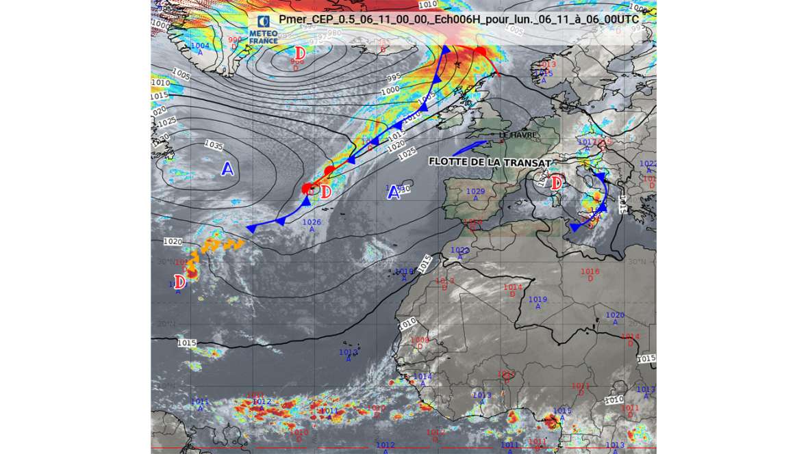
1. General synopsis for November 6, 2017 at 00:00 UTC:
Low 967 hPa between Greenland and Iceland moving east at 20kts.
Associated trough tonight from the Irish Sea toe Cape Finisterre.
High 1030 hPa over Cape Finisterre, extending with a ridge of high pressure over south-west England.
This ridge is turning east and passing over the fleet today.
High 1038 hPa west of Terre Neuve moving south-east.
2. Weather forecast from November 6, 2017 at 09:00 UTC to November 7, 2017 at 12:00 UTC:
IROISE, USHANT: variable northerly prevailing 3/6kts becoming south-west 8/12kts at midday, increasing 15/25kt gusting 35kt later, then 25/30kt gusting 45kts tonight, veering north-west 30/35kt gusting 40kt tomorrow morning.
Sea moderate becoming rough and crossing 3/4 m tonight. rain then showers later.
PAZENN: becoming south-west quickly from west 10/20kts increasing gradually 28/35kts gusting 40kts later, veering north-west 25/30kt gusting 40kt from north-west tonight.
Sea moderate becoming rough, then very rough and crossed before the front - 4 or 5m.
Rain in the afternoon then showers overnight from the west.
ROMEO: south-westerly 25/35kts from east to west, gusting 45kts crossing the front, veering north-west 25/30kts gusting 40kts around the afternoon, decreasing 15/20kts in west tomorrow.
Sea rough to very rough and crossed before the front - 3 to 5m from east to west.
Rain followed quickly by showers.
3. Further outlook from November 7, 2017 at 12:00 UTC to November 8, 2017 at 12:00 UTC:
Strong wind warning (greater than 40kts): No warning
High wave warning (greater than 6m): No warning
Monday, November 6, 2017 at 07:34 UTC.
Richard Silvani
Météo-France


